Example 8 - Tanglewilde Subdivision
Contents
Example 8 - Tanglewilde Subdivision#
An example adapted from a homework assignment in an engineering design course
Objective#
This example is to apply SWMM to a simple drainage network that combines overland, street, and sub-surface storm drains into a single integrated model to inform pipe sizing decisions.
Situation#
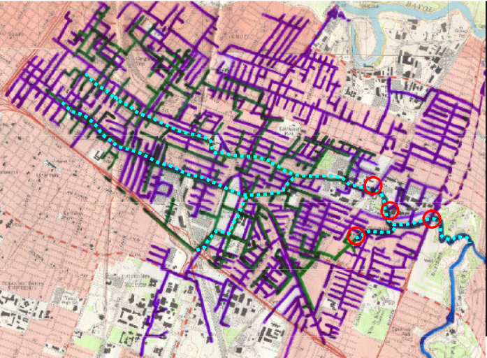
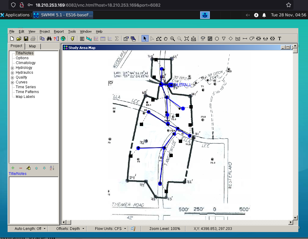
The figure below is an aerial image of a portion of Houston, Texas. The red polygon is the drainage boundary for a storm sewer system that drains North from the part of the area near Westheimer Road to a tributary of Buffalo Bayou and East from the area. The drainage ditch, which drain to the East, is shown as the “blue” fuzzy line on the figure.
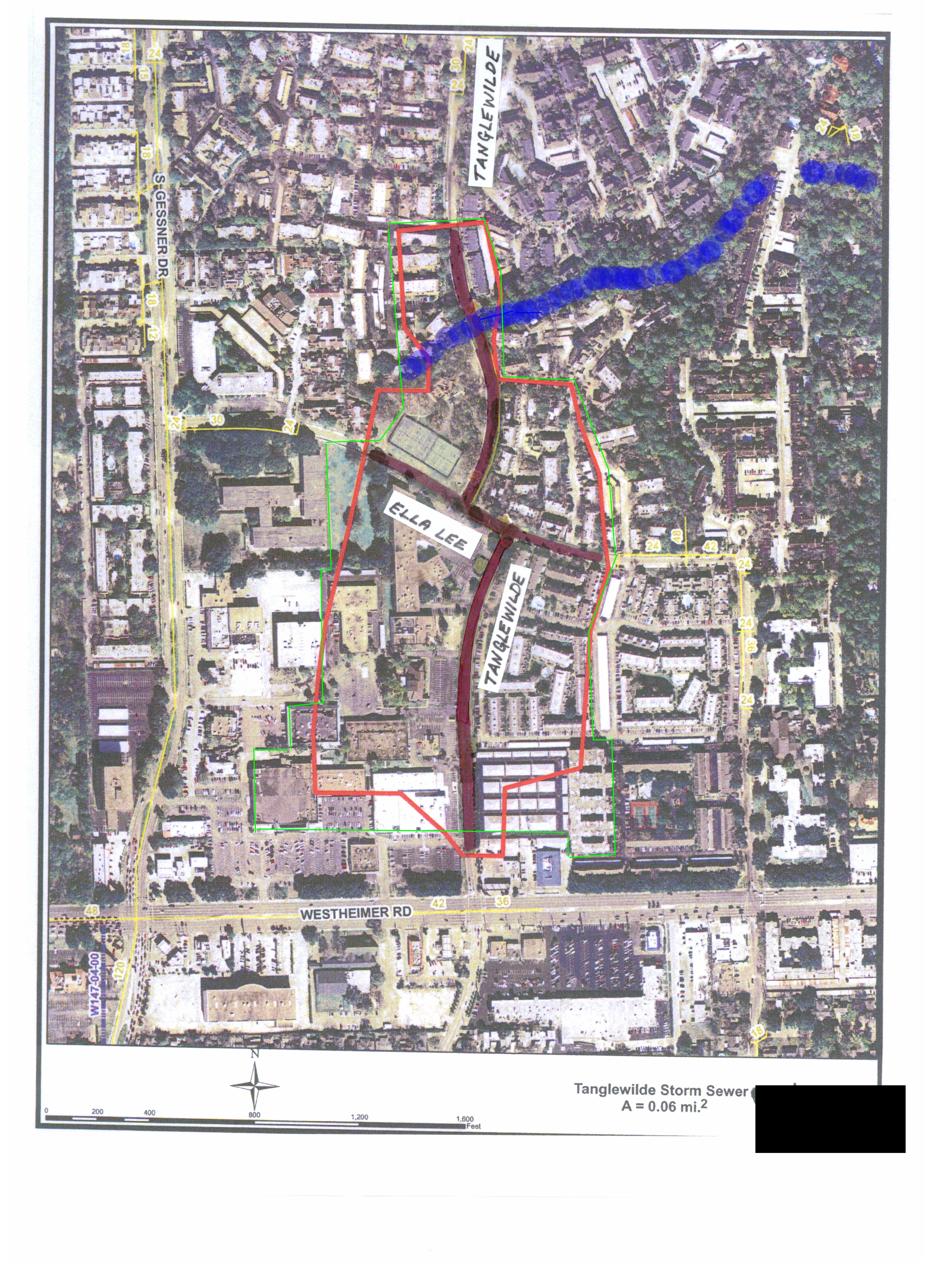
The two main streets in the study area are highlighted in magenta.
The goal is to size the storm water drainage system depicted below.
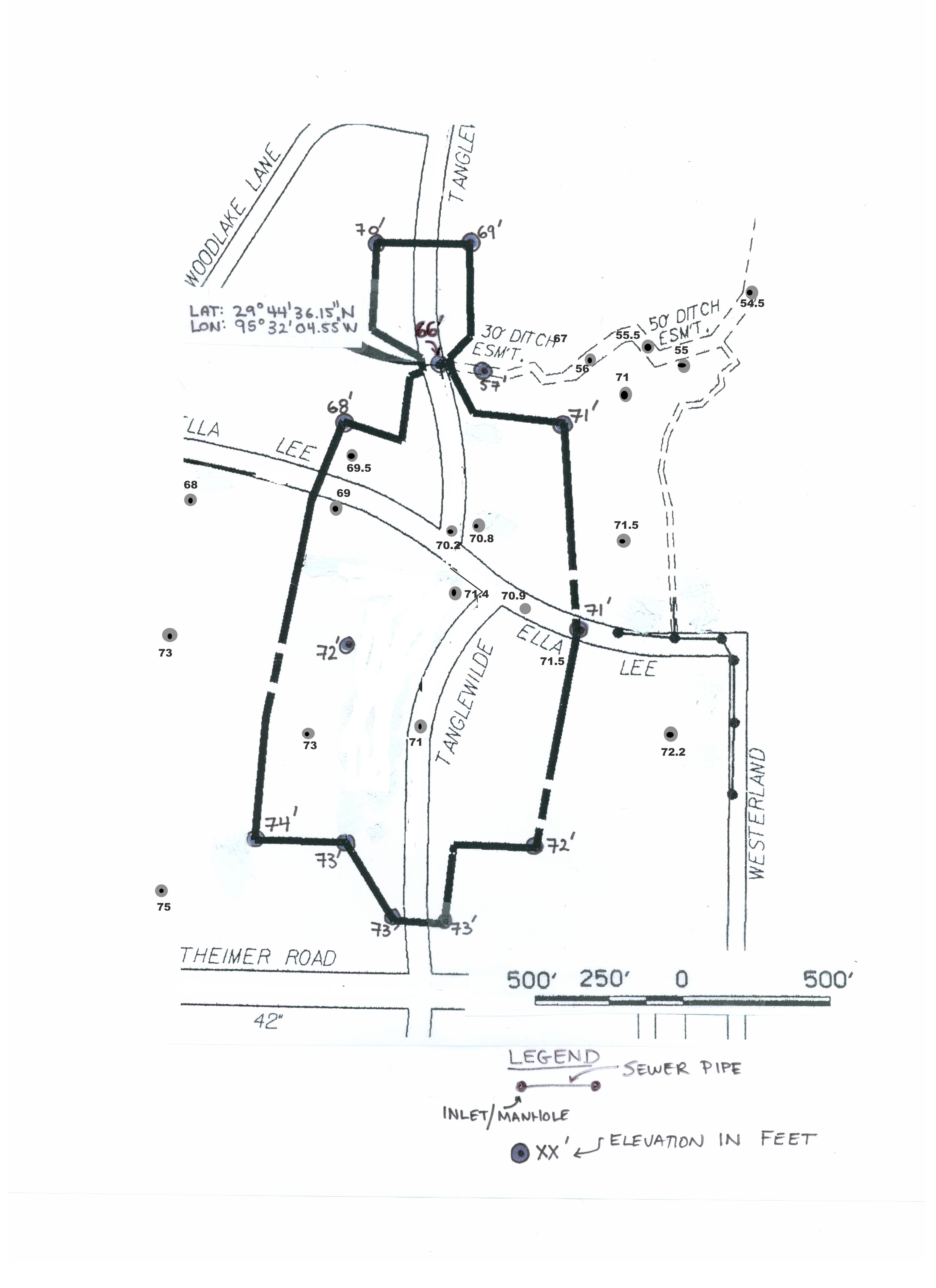
Using initial designs from a Rationl Method CITE design approach , which covers the same location, test the design using SWMM [CITE] for a 5-yr, 6-hour storm. If the storm sewer surcharges, then modify the design to accommodate the storm. Model the system as a dual-drainage system (surface street drainage, and sub-surface storm sewers). The applications manual has some examples of dual-drainage system (Gironas et. al. 2009), as does the report by Cleveland and Botkins, 2008.
Supporting Data Files#
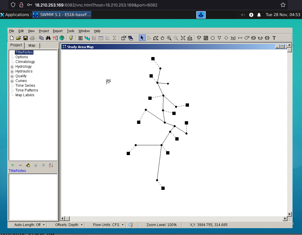
ES16-BaseFile.inp The network sized from Rational Method ready for testing performance and design changes.
ES16-Layout.bmp A background image for visualizing the network
Simulation Results#
To access this example using FreeSWMM launch the browser access and open SWMM using WINE. Then navigate to the Tanglewilde directory from the File/Open menu item.
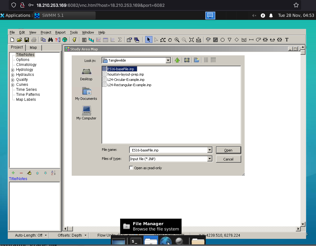
Once in the correct directory choose ES16-BaseFile.inp to start.
Then load the backdrop if desired.
Then we can run the simulation with a desired design storm and interrogate depths using the profile tool to decide if the storm drain is adequate, under- or over-sized.
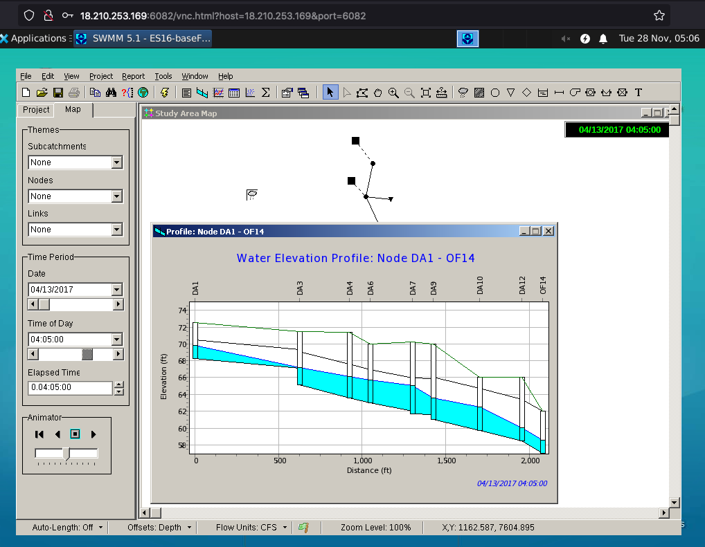
Interpretation#
The simulation results suggest the storm drain is adequate as supplied in the input file (none of the pipes surcharge). Ancillary to SWMM the cover in some locations is sparse and backfill would need to be stabilized to resist traffic loads.
References#
Rossman, L. (2009). Storm Water Management Model user’s manual version 5.0. Tech- nical Report EPA/600/R-05/040, U.S. Environmental Protection Agency, National Risk Management Research Laboratory Cincinnati, OH 45268.
Gironas, J., L. A. Roesner, and J. Davis (2009). Storm Water Management Model appli- cations manual. Technical Report EPA/600/R-09/077, U.S. Environmental Protection Agency, National Risk Management Research Laboratory Cincinnati, OH 45268.